
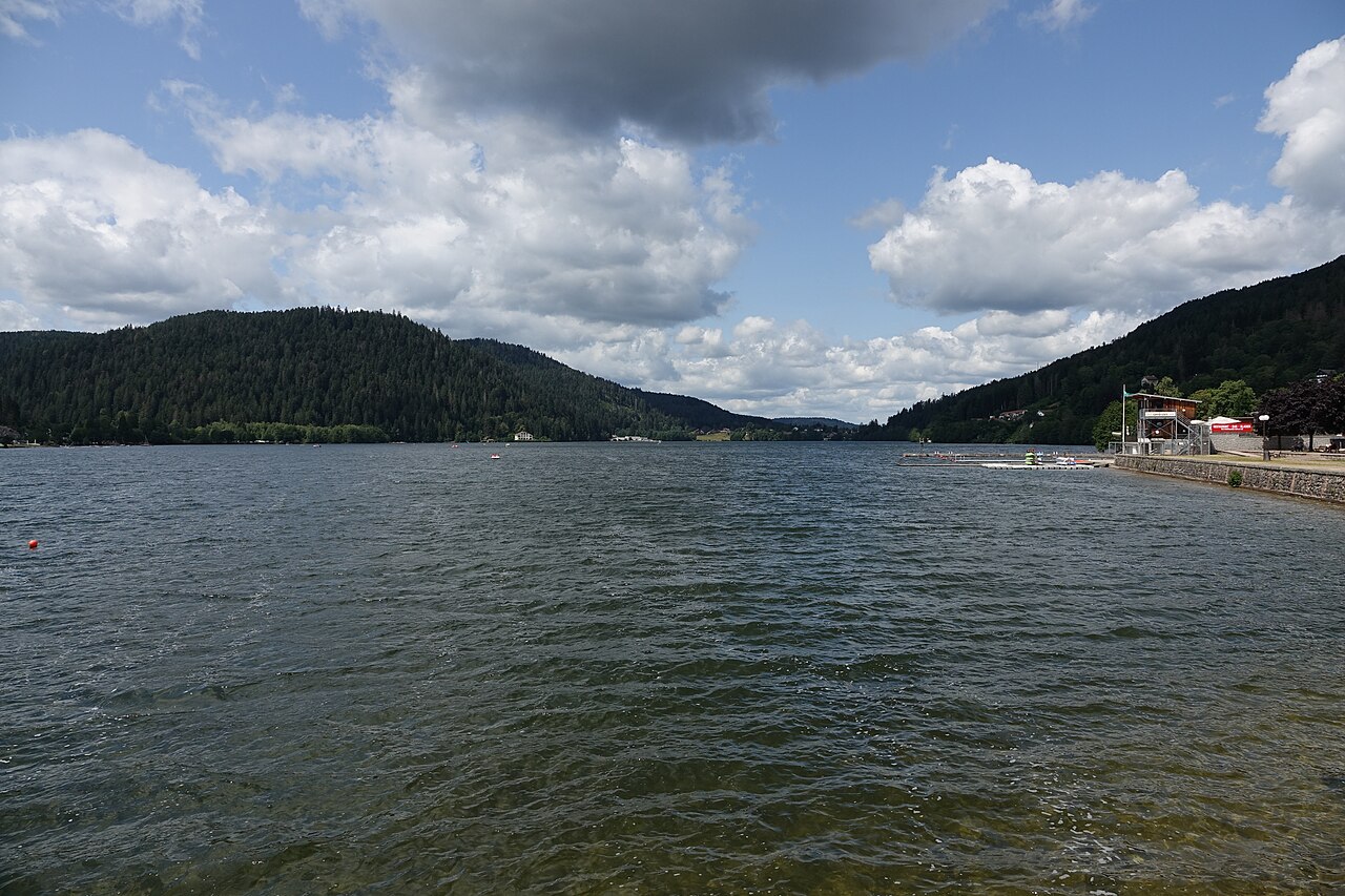
The Tour de Mérelle, also known as the Mérelle observatory, stands over Gérardmer at 897 metres and gives a 360-degree view over the lake, the town and the alpine ski area. It is one of the most sought-after viewpoints in the Hautes-Vosges, often reduced to a single photo on other sites. Here is the access route, the official loop and the history of the site, so you can plan a proper outing.
Where the Tour de Mérelle is and how to reach it
The site sits on top of the tête de Mérelle, at 897 m, above the lake of Gérardmer. The Gérardmer Hautes Vosges Tourist Office states that this summit can only be reached on foot or by mountain bike.
An important point for planning the outing: the Mérelle observatory has no longer been reachable by car since mid-June 2023. The recommended parking spot is on the D69, by the H. Millan football stadium car park. From there, the route follows the blue disc waymarking, shown on an ONF sign near the recycling point, between the chemin des Rochottes and the chemin du Tour du Lac.
A mountain bike circuit (no. 10, red waymarking, “Saut de la Bourrique - Tête de Mérelle”) also allows equipped riders to reach the site by bike.
The official loop to the observatory and the Mérelle waterfall
The loop route approved by the Tourist Office has the following characteristics:
| Feature | Official data |
|---|---|
| Distance | 5.4 km |
| Elevation gain | 240 m |
| Difficulty | Moderate |
| Waymarking | Blue disc |
| Route | Loop |
The KML track can be downloaded directly from the official listing. The route leads to the cascade de Mérelle, on the stream of the same name, and passes close to the tourbière du haut de Mérelle (a peat bog), whose plant and animal species are protected. For comparison with another peat bog in the massif, the tourbière du lac de Lispach can be explored on a dedicated educational trail, described by the La Bresse Tourist Office.
The Mérelle waterfall drops from a porphyry slab in two main streams, over a height of 5 metres. Its flow stays modest, especially in dry periods. The stream then flows into the lake of Gérardmer. Those who prefer a more abundant waterfall in the Vosges will find a different profile at the cascade de Tendon, which pairs well with this hike over a separate half-day.
Weather conditions can make the route impassable, as the Tourist Office notes on the official listing: it is best to check ground conditions before setting off, especially after heavy rain.
The observatory: a lookout tower built by scouts
The history of the site is documented by the Gérardmer Tourist Office. In July 1964, a group of scouts hiking in the hills above Gérardmer stopped at this promontory overlooking the lake. That discovery led to the project of building a wooden lookout tower: the current tower has 85 spiral steps.
From the top, the view opens up across 360 degrees: the lake of Gérardmer in the foreground, the Gérardmer Stations alpine ski area and the Route des Crêtes further back. It is a full view over the valley, hard to match at such a modest altitude.
For a longer outing in the same massif, the col de la Schlucht hiking guide covers official routes toward the Hohneck, with distances above those of the Mérelle loop.
Before you go: what to check
- D69 parking, H. Millan stadium car park: the best option, since direct car access to the observatory has not existed since mid-2023.
- Blue disc waymarking to follow from the ONF sign between chemin des Rochottes and chemin du Tour du Lac.
- Proper hiking shoes: the loop covers 240 m of elevation gain over 5.4 km, rated moderate difficulty.
- Respect for the protected peat bog areas near the route: stay on the marked trail.
- Check the weather before setting off: parts of the ground can become hard to walk on.
- A mountain bike option is available via circuit no. 10 (red) for cyclists.
Climbing the tower’s 85 steps stays within reach of a fairly wide range of people physically, but the full 5.4 km loop with 240 m of elevation gain calls for a reasonable level of fitness, especially with children. For a shorter outing around a body of water, the tour du lac de Blanchemer offers a noticeably easier alternative, with a loop of about 1 km according to the La Bresse Tourist Office.
Key points
The Tour de Mérelle combines three features that are rare this close to Gérardmer: a 360-degree view over the lake and the town, a 5-metre waterfall and a protected peat bog close by, all on an official 5.4 km loop. The main point to watch is access: since mid-2023, reaching it means walking or cycling from the H. Millan stadium car park, since the observatory is no longer served by road.
The La Bresse guide, summer edition
Trails, lakes, blueberries and farm inns, in one free PDF.
Your details are used only to process this request. Privacy policy (in French).
Free PDF, no newsletter sign-up.
Frequently asked questions
Where can you park to hike up to the Tour de Mérelle?
The Gérardmer Tourist Office points to parking on the D69, by the H. Millan football stadium car park. The Mérelle observatory has not been reachable by car since mid-June 2023, so you need to continue on foot or by mountain bike.
How many steps do you climb in the Tour de Mérelle?
The observatory is a wooden lookout tower with 85 spiral steps, built after a group of scouts spotted this viewpoint during a hike in July 1964, according to the Gérardmer Tourist Office.
How long is the hike to the Tour de Mérelle?
The official loop to the observatory and the Mérelle waterfall, marked with a blue disc, covers 5.4 km with 240 m of elevation gain. The Gérardmer Tourist Office rates its difficulty as moderate.