
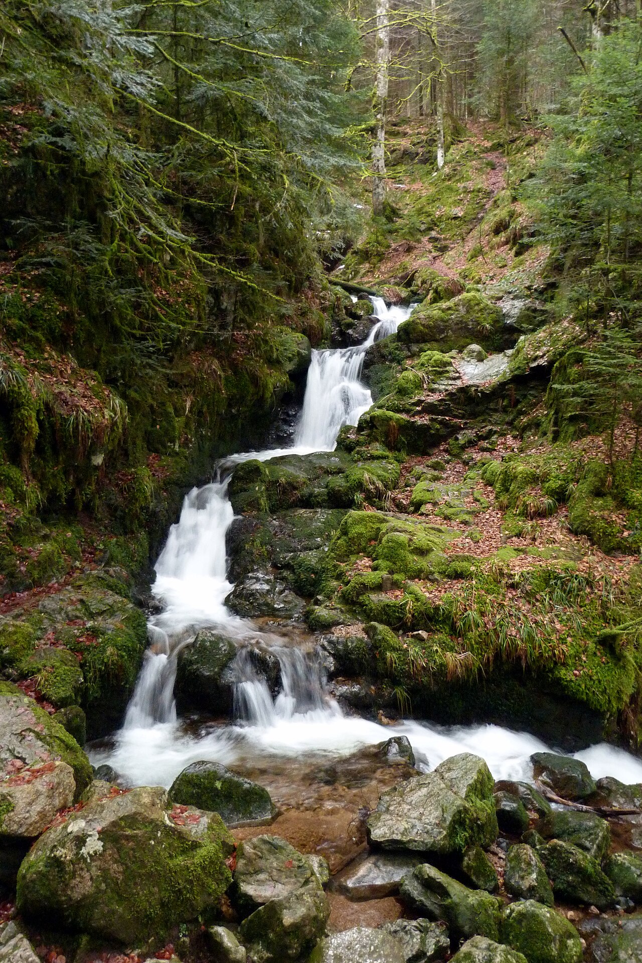
The cascade de Mérelle sits in the hills above Gérardmer, on the stream of the same name that flows down into the lake. The tourist office lists it at 5 meters, with water sliding over a porphyry slab in two strands. A waymarked trail leads there from the H. Millan football stadium car park, on the D69. The key point before you go: the official walk that leads there is rated Moderate, not easy, which matters for a family outing.
What you’ll find at the cascade de Mérelle
The cascade de Mérelle is nothing like the dramatic drop at Tendon, rated among the highest in the Vosges at around 30 meters. Here, the water of the Mérelle stream slides over a porphyry slab in two main strands, at a height of 5 meters according to the official fact sheet from the Gérardmer tourist office. The flow stays modest, which makes the spot feel more discreet, better suited to a quiet break in the forest than a dramatic show.
The stream then continues on to Lac de Gérardmer, where it flows in. The site is open access, and pets are allowed.
Along the same route, the trail also leads to the Mérelle observatory, a wooden structure with a view over Lac de Gérardmer, the town, and the ski area, according to the tourist office’s fact sheet. The waterfall and the observatory can therefore be visited one after the other, on the same waymarked path.
Exact access: parking, starting point, and waymarking
The official starting point is as follows: park on the D69, at the H. Millan football stadium car park in Gérardmer. From this car park, follow the blue disc waymarking, shown on an ONF sign located between chemin des Rochottes and chemin du Tour du Lac.
Two things to check before you go:
- car access to the Mérelle observatory is closed to all motor vehicles from 1 June to 30 September each year, under a Gérardmer municipal order; during that period, access is on foot or by mountain bike only;
- weather conditions can make the trail impassable, especially after heavy rain on forest ground that stays damp.
No pricing or opening-hours information is published for this site: the trail is open access, as is the case for most Vosges forest waterfalls.
Difficulty level: what the official fact sheet really says
This is the most useful thing to know before you go. The hike listed by the Gérardmer tourist office as the “Balade de l’Observatoire et de la cascade de Mérelle,” reproduced with permission from the Club Vosgien, shows the following characteristics:
- Distance: 5.4 km, loop
- Elevation gain: 240 m
- Duration: 2h30
- Difficulty: Moderate
These figures cover the full circuit, which includes the climb to the observatory as well as the waterfall. For a family with young children, this is not the simplest hike in the Hautes Vosges: by comparison, the educational trail around lac de Lispach and the ténine peat bog is rated Easy over 4.5 km.
In practice, two options stand out for this outing near Gérardmer:
- Follow the full loop (5.4 km, 240 m of elevation gain, 2h30), suited to children used to walking in the forest and able to handle the distance.
- Reach the waterfall and turn back without pushing on to the observatory, which cuts down the distance and elevation gain, though the tourist office does not publish a separate figure for this shorter version.
Either way, plan on footwear suited to a forest trail that can stay damp, since the steady slope is more affected by bad weather than a flat path.
Making a day of it around Gérardmer
The cascade de Mérelle works well for a morning or an early afternoon, paired with other spots near Lac de Gérardmer. For a ridge hike with a real panorama over the high moorlands, head to the col de la Schlucht, about twenty minutes away by car. Those who prefer calmer water and the feel of a protected peat bog can head instead to lac de Blanchemer, further south towards La Bresse.
For waterfall fans, it’s worth comparing several sites over the same stay: the cascade de Mérelle for a short outing accessible to confident walkers, Tendon for the height of its drop, and the area around Lac de Gérardmer to combine a walk with the view from the observatory. Depending on the day’s plans and the age of the children in the group, these spots combine easily thanks to how close they are to each other around Gérardmer.
The La Bresse guide, summer edition
Trails, lakes, blueberries and farm inns, in one free PDF.
Your details are used only to process this request. Privacy policy (in French).
Free PDF, no newsletter sign-up.
Frequently asked questions
How tall is the cascade de Mérelle?
The Gérardmer tourist office lists a height of 5 meters. The water falls from a porphyry slab in two main strands, with a flow that is not very strong.
Where can you park for the cascade de Mérelle?
The official parking is on the D69, at the H. Millan football stadium car park in Gérardmer. From there, the walk starts on foot, following the blue disc waymarking shown on the ONF sign.
Is the walk to the cascade de Mérelle easy with children?
The official loop to the observatory and the cascade de Mérelle is rated Moderate on the Gérardmer tourist office fact sheet, covering 5.4 km, 240 m of elevation gain, and about 2h30 of walking. It is not an easy walk across the whole route: with young children, it's better to plan on turning back once you reach the waterfall rather than aiming for the observatory.