
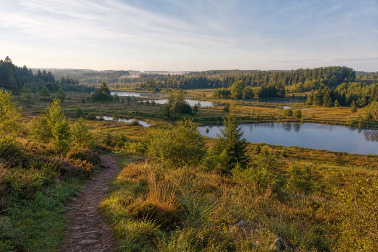
The Plateau des Mille Étangs covers more than 220 km² of heathland, forest and ponds, between Lure and Faucogney-et-la-Mer, in Haute-Saône. From La Bresse, it makes a full day trip that differs from the usual Vosges lakes: here, the landscape reads as hundreds of small scattered ponds rather than a few large lakes. This guide covers access, waymarked trails and practical information checked with the relevant tourist offices.
Understanding the Plateau des Mille Étangs
The plateau takes its name from a scatter of pools and ponds shaped by glaciers, then developed by monks and farmers from the Middle Ages onward for fish farming. It stretches from Lure to Faucogney-et-la-Mer, via Mélisey, Servance and the Col des Croix, on the southern slope of the Vosges. The Office de tourisme des 1000 Étangs lists more than 30 waymarked routes, a mountain bike base with four circuits, a horse riding route and fishing on the Breuchin, the Ognon and in private ponds subject to authorisation.
This point is worth clarifying before you go: some ponds are private and available for fishing only with permission. The plateau’s official activity list does not present a water sports base, so do not assume swimming or canoeing is allowed on any given pond. For a swim or paddle near La Bresse, consult the official alternatives to the Lac des Corbeaux and check the rules for each site.
Getting there from La Bresse
No tourist office publishes a fixed travel time between La Bresse and the plateau: the two areas belong to different departments (Vosges and Haute-Saône) and the road crosses several mountain passes. The logical route runs through Cornimont then Le Thillot or Saint-Maurice-sur-Moselle, before crossing the Col des Croix toward Servance, Faucogney-et-la-Mer or Mélisey depending on the area you are heading for. This approach via the south of the Hautes Vosges is the same one used to reach the Ballon d’Alsace from La Bresse, before turning off toward Haute-Saône. Traffic, roadworks and weather affect the actual journey time, so check the day’s route before setting off.
Two tourist information offices cover the area: Mélisey (Place de la Gare, 70270 Mélisey, 03 84 63 22 80) and Faucogney-et-la-Mer (7 Grande Rue, 70310 Faucogney-et-la-Mer, 03 84 49 32 97). They provide maps of the hiking and mountain bike routes, useful for locating the ponds precisely on the ground.
The Saut de l’Ognon trail: a short walk at Servance
For a first look at the plateau, the Saut de l’Ognon trail at Servance-Miellin is a short option. The official tourism page gives 600 metres there and back to a waterfall 14 metres high, originally shaped by a glacial rock sill, then developed to power a former granite works via a channel cut into the rock, still visible at the top of the fall. The short distance does not guarantee universal accessibility: check the ground and weather before setting out.
A car park and picnic tables are installed at the entrance to the village of Servance, according to the official page of the Massif des Vosges. The trail ends overlooking the waterfall: children should be watched despite the barriers, the information sign on site notes.
For walkers who want to extend the outing, the Office de tourisme des 1000 Étangs lists around thirty other waymarked routes between ponds, peat bogs and beech forests, with maps available at both information offices or online at les1000etangs.com.
Cycling, horse riding and fishing: the plateau’s other activities
Beyond hiking, the plateau offers a mountain bike base with four circuits and two gravel routes. The Communauté de Communes des 1000 Étangs also rents out hybrid bikes and electric-assist mountain bikes, at 25 euros for a half day and 35 euros for a full day, with a 5 euro discount on presentation of a tourism pass. These prices were checked on 30 July 2026 and should be confirmed when booking. A horse riding route also crosses the area, and both the Breuchin and the Ognon offer river fishing, with a few private ponds added under specific authorisations to request from the Mélisey or Faucogney offices.
Autumn gives the landscape a different character, with copper-coloured beech woods reflected in the ponds. Conditions and colour timing vary from year to year, so check locally before planning a trip specifically around autumn foliage.
Motorhome stopovers on the plateau
The official 1000 Étangs website now links to a dedicated map of motorhome stops and services. As capacity, prices and facilities can change, consult that map and confirm the conditions with the Mélisey or Faucogney information office before planning an overnight stay.
Planning your day
A day trip to the plateau works best built around one clear goal rather than a string of sites: the Saut de l’Ognon trail for a short, family friendly walk, extended if you like with a longer loop between ponds or a mountain bike ride. Contact Mélisey or Faucogney before setting off to confirm opening times and pick up the current route map, as practical information changes from one season to the next.
For another nature outing from La Bresse the same summer, compare with the Ballon d’Alsace guide, which covers very different access and terrain at a comparable distance.
The La Bresse guide, summer edition
Trails, lakes, blueberries and farm inns, in one free PDF.
Your details are used only to process this request. Privacy policy (in French).
Free PDF, no newsletter sign-up.
Frequently asked questions
How far is the Plateau des Mille Étangs from La Bresse?
No tourist office publishes a fixed travel time from La Bresse: the plateau is reached via Cornimont, Le Thillot or Saint-Maurice-sur-Moselle, then the Col des Croix toward Servance, Faucogney-et-la-Mer or Mélisey. Check the route and road conditions on the day you travel.
Can you canoe on the ponds of the plateau?
Activities officially listed by the Office de tourisme des 1000 Étangs include hiking, cycling, horse riding and fishing. No water sports base is signposted on the plateau itself and some ponds are private: do not assume swimming or canoeing is allowed.
Which short walk can you choose to discover the site?
The official tourism page gives 600 metres there and back to the Saut de l'Ognon, a 14 metre waterfall with parking and picnic tables. Short does not mean accessible to everyone: check the surface and keep children supervised near the fall.