
The Ballon d’Alsace is a southern Vosges summit where the territories of Lepuix, Saint-Maurice-sur-Moselle and Sewen meet. Its natural high point reaches 1,247 metres. The road pass, Maison du Ballon d’Alsace and Démineurs area stand at 1,171 metres. This distinction explains why both elevations are commonly shown for the same destination.
This guide is for a walking day trip from La Bresse: access, parking, the summit trail and walks published by local institutions. For gradients, road profiles and cycling routes, use the separate Ballon d’Alsace cycling guide.
Reaching Ballon d’Alsace from La Bresse
From La Bresse, the logical approach is the Vosges side. Travel towards Le Thillot, then follow the RN66 to Saint-Maurice-sur-Moselle. In Saint-Maurice, the official access page says to follow signs for “Ballon d’Alsace / Belfort”.
This page does not give a fixed journey time from La Bresse because traffic, works, weather and the chosen stopping point can change it. Check a live route and road information before leaving. The Le Thillot guide can help plan a valley stop, but only add one if it fits the day.
The site manager distinguishes two areas about 3 km apart:
- Démineurs / Col du Ballon, at 1,171 m: visitor centre, discovery trail, monuments and main walking starts;
- Gentiane, at 1,050 m: a separate activity area and another walking base.
Choose the area before starting navigation. For the summit and discovery trail, enter Maison du Ballon d’Alsace or Parking des Démineurs.
Parking and visitor information
The official site lists several free car parks. Parking des Démineurs is beside Maison du Ballon d’Alsace and serves the summit trail. Gentiane, Langenberg and Tête des Redoutes serve other starting areas. Park in a listed space rather than on the roadside; one summit area is reserved for coaches.
Maison du Ballon d’Alsace, at 42 Route du Ballon d’Alsace in Saint-Maurice-sur-Moselle, provides information on the massif and its valleys. When checked on 15 July 2026, its official page displayed:
- visitor-desk opening every day in July and August, 9.30 am–12.30 pm and 1.30–5.30 pm;
- a shelter room, toilets, water point and lockers advertised from 9 am to 5 pm throughout the year.
These times and services can change. Check the official Maison du Ballon d’Alsace page on the morning of the trip.
The La Bresse guide, summer edition
Trails, lakes, blueberries and farm inns, in one free PDF.
Your details are used only to process this request. Privacy policy (in French).
Free PDF, no newsletter sign-up.
Four official walks compared
| Route | Official distance | Official duration | Best for |
|---|---|---|---|
| Discovery trail | 3–4 km | 1–1.5 hours | Summit, monuments and ten interpretation panels |
| Ballon d’Alsace family walk | 6 km | 2 hours | Woodland and viewpoints with the family |
| Tour du Ballon | 9.4 km, 386 m ascent | 3.5 hours | A longer loop around the massif |
| Balade des points de vue | 10.2 km, 485 m ascent | 4 hours | Route rated difficult on the official sheet |
Distances and durations come from official route pages checked on 15 July 2026. They help compare options but do not replace the route sheet, waymarks or an assessment of current conditions.
Discovery trail: the essential visit
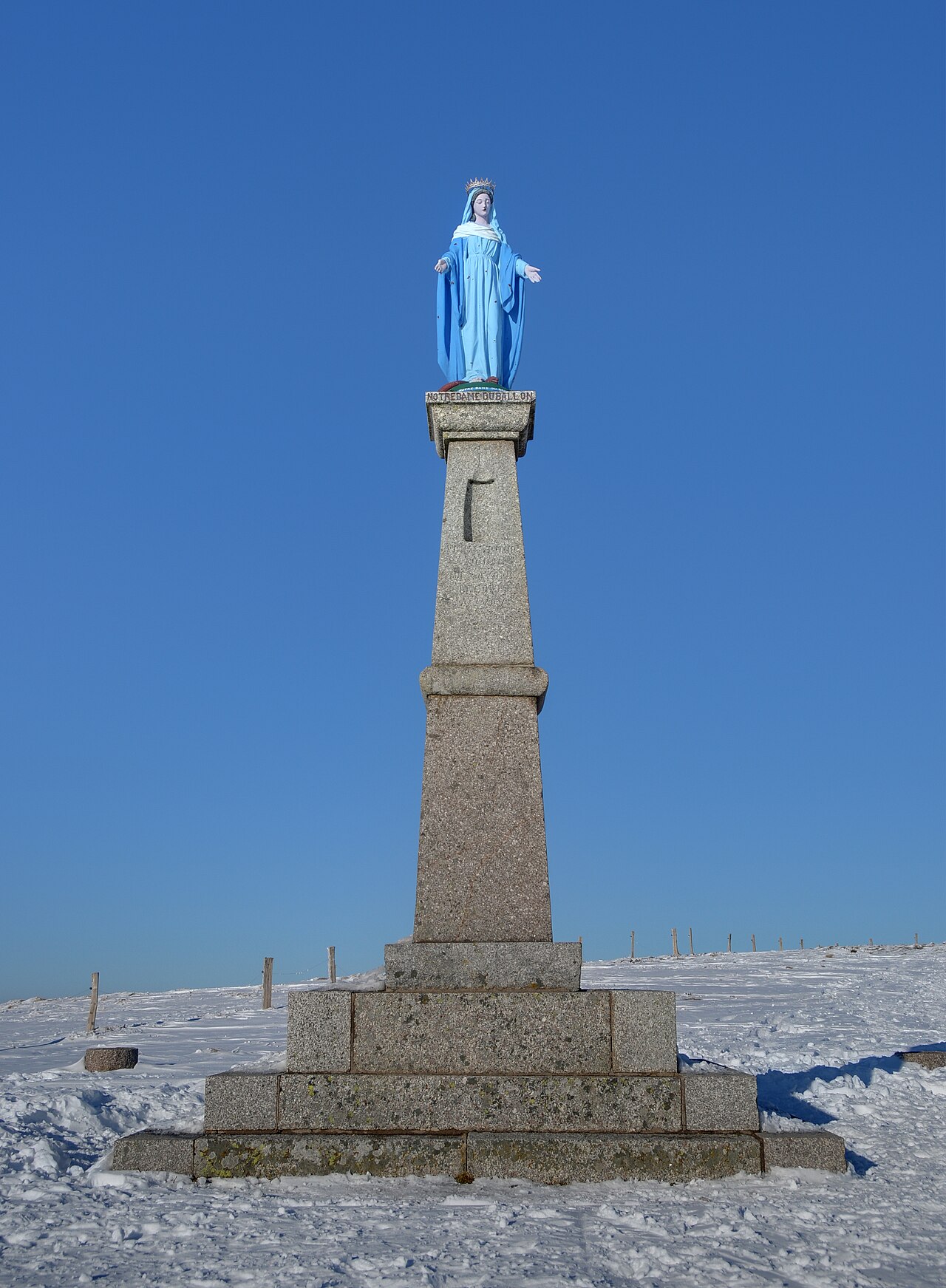
The discovery trail loops around the upland meadow and reaches the 1,247-metre high point. Ten panels cover topics including climate, geology, water, vegetation, history and mountain economy. The route passes the Joan of Arc statue, orientation table, Notre-Dame du Ballon and the national Démineurs monument.
The manager describes it as “accessible to everyone”, but this is not a pushchair or wheelchair certification. Contact Maison du Ballon before travelling if your group has a specific accessibility requirement.
Two ways to extend the walk
The 6 km family walk is published by Massif des Vosges with a duration of 2 hours. Regular walkers can choose the 9.4 km Tour du Ballon. The Balade des points de vue descends farther into the massif before climbing back to Démineurs; its official sheet rates it difficult and allows 4 hours.
Download the chosen route sheet from the official walking selection instead of joining fragments from several tracks.
A Ballon d’Alsace day with children
The simplest plan combines Maison du Ballon, a picnic that respects site rules and the discovery trail. It remains easy to shorten without promising that every young child will complete the full circuit.
The official programme checked on 15 July 2026 also advertised free guided family walks from age 5, with limited places and compulsory booking. The starting point is provided when booking. Check the dates still available with the organiser rather than relying on an old listing.
For routes closer to your accommodation, compare the family walks in La Bresse.
Weather, equipment and protecting the massif
The summit is exposed. Check the weather in La Bresse and on the summits, carry water, a warm layer and rain protection, and wear suitable footwear. For longer routes, take the official route sheet and leave a margin before nightfall.
Institutional guidance asks walkers to stay on marked trails, keep dogs on leads, respect fences and livestock, avoid picking flowers, light no fires and carry all rubbish out. The Quiétude Attitude programme also asks visitors to avoid disturbing wildlife in sensitive areas and seasons.
Ballon d’Alsace, cycling or Route des Crêtes: which guide?
- this page covers visiting, access, the summit and walking;
- Ballon d’Alsace by bike covers the road climb and cycling profiles;
- the Route des Crêtes guide covers a separate panoramic itinerary to plan from La Bresse.
Keep the day realistic by choosing one main destination instead of combining Ballon d’Alsace, Route des Crêtes and several long walks. See where to stay in La Bresse and set the final plan according to the morning weather.
The La Bresse guide, summer edition
Trails, lakes, blueberries and farm inns, in one free PDF.
Your details are used only to process this request. Privacy policy (in French).
Free PDF, no newsletter sign-up.
Frequently asked questions
How high is the Ballon d'Alsace?
The natural summit reaches 1,247 metres. The road pass and Maison du Ballon d'Alsace are lower, at 1,171 metres, so the two elevations refer to different landmarks.
How do I reach Ballon d'Alsace from La Bresse?
The official Vosges-side access runs via Le Thillot and Saint-Maurice-sur-Moselle. In Saint-Maurice, follow signs for Ballon d'Alsace and Belfort. Check the route and road conditions on the day.
Which walk should I choose with children?
The summit discovery trail is the shortest choice: the site manager gives 3 to 4 km and 1 to 1.5 hours. There is also an official 6 km, 2-hour family walk.
Can I reach the summit without a long hike?
Yes. The discovery trail starts in the Démineurs area, reaches the high point and loops around the upland meadow in 3 to 4 km. Suitable mountain footwear is still required.
Where should I park for the summit trail?
The free Démineurs car park is beside Maison du Ballon d'Alsace. The official site lists other car parks by area; spaces reserved for coaches must not be used.