Two mountain lakes share the south slope of the Grand Ballon, above Guebwiller: Lac de la Lauch, a historic reservoir set in the valley of the same name, and Lac du Ballon, a glacial basin at the foot of the highest summit in the Vosges. From La Bresse, combining both lakes with a climb to the Seebach waterfalls makes for a full day out, a change from the usual loops around the village. Here is the altitude, access and hiking links for each site, based on the information sheets from the Guebwiller region tourist office.
Lac de la Lauch: a reservoir from the valley’s industrial past
Lac de la Lauch sits at 923 metres, covering around 11 hectares. It is an artificial reservoir, built to feed the Lauch river and supply the textile industry of the Guebwiller valley, much like the lakes of Alfeld and Kruth-Wildenstein further north in the range.
Access is via the road linking Guebwiller to the Route des Crêtes, following the Lauch valley uphill. Beyond the lake, the road continues to the Markstein, above 1,100 metres, one of the access points to the Route des Crêtes in the Vosges.
Fishing is allowed on the lake, subject to a valid fishing permit and fee. Two waymarked routes start from the area: a full-day loop around the Markstein of around 14 km, crossing the lake, the forest and several ferme-auberges, and a more direct route from Linthal linking Lac de la Lauch to the Route des Crêtes and the Markstein.
Lac du Ballon: a glacial lake below the highest summit in the Vosges
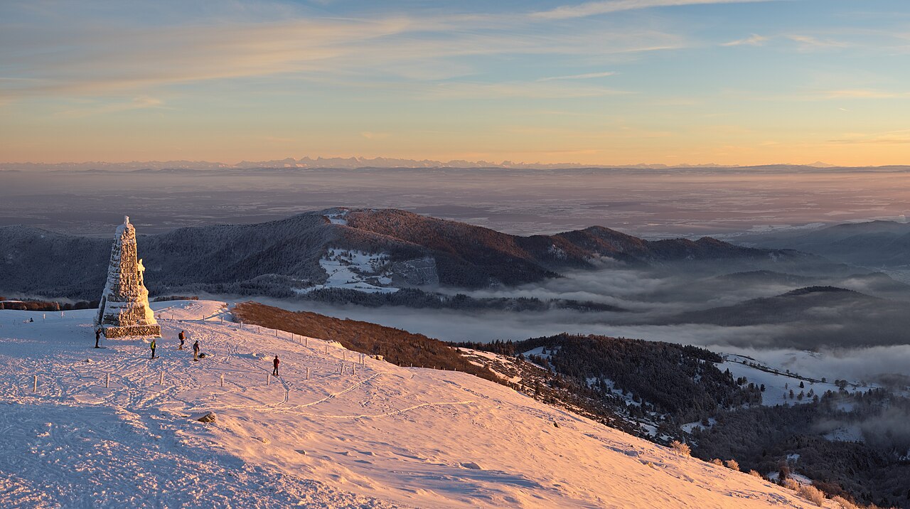
At 986 metres, Lac du Ballon covers around 7 hectares. Unlike Lac de la Lauch, it is glacial in origin: an additional dam was built there under Vauban, giving the site a double history, both natural and military. It sits in a mountain cirque directly below the Grand Ballon, the highest point in the Vosges.
Nearby, the ferme-auberge du Gustiberg, at around 980 metres, offers an open view over the lake and makes a classic stop for a marcaire meal after the walk. The site suits photography and a quiet walk along the water more than a long hike in itself: its role as a starting point toward the Grand Ballon and the opposite slope is what makes it a worthwhile stop.
To compare with another mountain lake with a very different profile, closer to La Bresse, see our guide to Lac de Blanchemer, also formed in a glacial cirque but bordered by a protected peat bog.
Cascade du Seebach: the link via the north-east slope
In the town of Linthal, the cascade du Seebach forms a series of waterfalls stepping down over several hundred metres, on the north-east slope of the Grand Ballon. Access is via a path marked as steep by the tourist office: this is not a flat stroll.
The Guebwiller tourist office offers an official route linking the two areas: the Sentier des Châteaux Forts n°3. This 12 km circuit, taking around 6 hours of walking for 480 metres of elevation gain, starts from the Col du Monument Brun in Linthal. It first crosses the ruins of the Husenbourg castle, then the Seebach waterfalls, before reaching Lac du Ballon. The matching topo-guide is sold at the Guebwiller region tourist office.
Planning the trip from La Bresse
From La Bresse, the south slope of the Grand Ballon is reached via the Route des Crêtes toward the Markstein, then down into the Lauch valley, or via the Munster valley and Linthal to reach the Lac du Ballon area directly. Distance and travel time vary widely depending on the route and the season the passes are open: check the state of the Route des Crêtes before you go, especially outside summer.
The Sentier des Châteaux Forts n°3 combines all three sites (castle, waterfalls, lake) into a single demanding day of walking, better suited to hikers used to elevation gain. For a shorter outing, Lac de la Lauch can be visited on its own from the road, with no walking required, making it an accessible option alongside a more classic hike on the crests.
To vary lake excursions from La Bresse, also compare with Lac de Lispach and its floating peat bog, closer to the village and reachable without a long drive.
Before you go
- Check whether the Route des Crêtes and the relevant pass are open for the season.
- Bring a valid fishing permit and fee if you plan to fish at Lac de la Lauch.
- Wear proper footwear for a steep path if you head up toward the Seebach waterfalls: this is not a flat, family-friendly walk.
- The topo-guide for the Sentier des Châteaux Forts n°3 is available at the Guebwiller region tourist office, useful for following the waymarking over the 12 km circuit.
These two lakes offer a concrete window into the history of the range: one tells the story of the Guebwiller valley’s textile industry, the other of glaciation and military works under Vauban. A good reason to step outside the usual triangle of La Bresse lakes for a day.
The La Bresse guide, summer edition
Trails, lakes, blueberries and farm inns, in one free PDF.
Your details are used only to process this request. Privacy policy (in French).
Free PDF, no newsletter sign-up.
Frequently asked questions
Are Lac de la Lauch and Lac du Ballon natural lakes?
One is, the other isn't. Lac de la Lauch is an artificial reservoir built for the valley's textile industry, at 923 m and covering 11 hectares. Lac du Ballon is glacial in origin, at 986 m and covering 7 hectares, with an additional dam built under Vauban.
Can you fish at Lac de la Lauch?
Yes, fishing is practiced there, but it requires a valid fishing permit and fee, as on most Vosges lakes managed by an approved association. Check with the Guebwiller region tourist office before you go.
How do you link Lac du Ballon to the Seebach waterfalls?
The Guebwiller tourist office lists the Sentier des Châteaux Forts n°3: 12 km, around 6 hours of walking and 480 m of elevation gain, starting from the Col du Monument Brun in Linthal. The route passes the ruins of the Husenbourg castle, the Seebach waterfalls, then Lac du Ballon.