
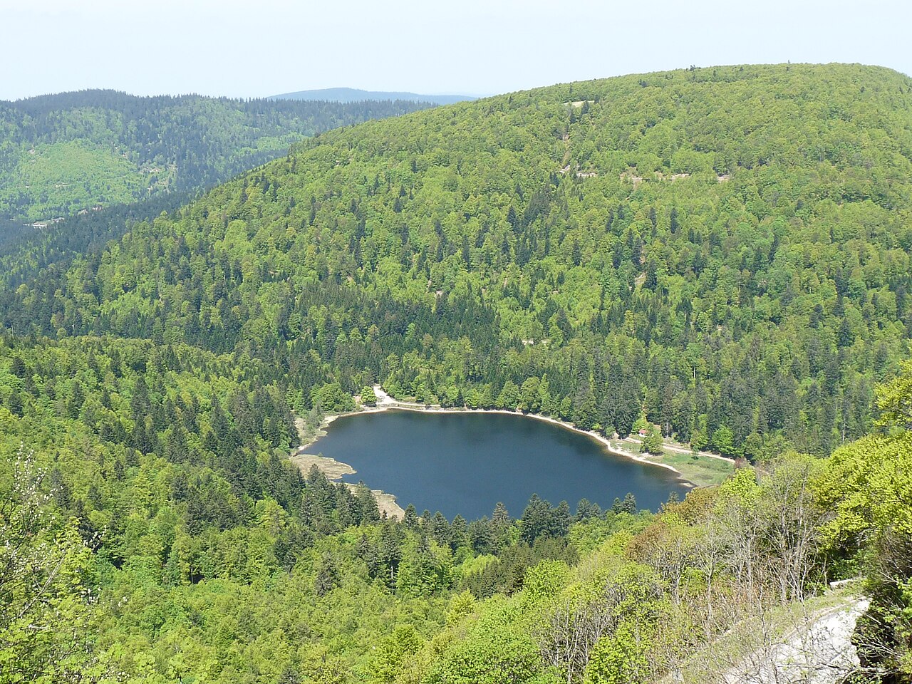
Lac du Forlet, also known as lac des Truites, fills a glacial cirque at 1,061 metres above sea level in the town of Soultzeren. It is the highest lake in the Vosges massif, not to be confused with the lakes of Longemer or Retournemer, which sit in an entirely different valley. This guide covers its exact location, how to reach it from La Bresse, and the official hike leading there.
A lake in the vallée de Munster, not La Bresse
Lac du Forlet lies on the Alsatian side of the Vosges, in the town of Soultzeren, in the vallée de Munster. It occupies a 2.8-hectare glacial basin overlooked by the Tanet (1,292 m) and the Gazon de Faîte (1,306 m), close to the Tanet-Gazon du Faing nature reserve. The landscape combines peat bog, steep rock faces, and scree, according to the vallée de Munster tourist office.
This site has nothing to do with the lakes of Longemer and Retournemer, which border the vallée des Lacs on the Gérardmer side. The confusion comes from the name “lac des Truites,” sometimes used for other bodies of water in the Hautes Vosges: here, it refers specifically to lac du Forlet in Soultzeren.
Getting there from La Bresse via the Route des Crêtes
For visitors staying in La Bresse, reaching lac du Forlet means taking the Route des Crêtes then the col de la Schlucht. From the pass, the D417 continues towards Soultzeren, heading for Lac Blanc and Orbey. The hike starts from the Tanet car park, about 5 km past Soultzeren on that same D417.
This ridge road crosses open landscapes over the high pastures before dropping down the Alsatian slope. It lets you combine, in a single day, a stop at the Hohneck and a visit to lac du Forlet, as long as you allow enough travel time between the two areas.
The official Deux Lacs hike
The waymarked circuit run by the Club Vosgien de la vallée de Munster, called “Les Deux Lacs,” links lac Vert and lac du Forlet, starting from the Tanet car park. According to the tourist office’s official route sheet:
| Feature | Value |
|---|---|
| Distance | 8 km |
| Duration | 3 hours |
| Elevation gain | 350 m |
| Level | Intermediate |
| Start point | Tanet car park |
The route first follows the “Lac Vert, lac du Forlet/truites” direction, crosses the jetty at lac Vert, then climbs towards the hamlet of Gaerstlesrain, home to the Club Vosgien’s Erichson chalet, open to all. The path then descends towards the Tiefenbrunnen area before reaching lac du Forlet, where you can continue on to the peat bog above the ferme-auberge. The return leg follows a variation of the outbound path back to the car park.
For a meal stop, the ferme-auberge du Forlet serves traditional marcaire cuisine and Munster cheese on a terrace facing the lake, according to the vallée de Munster tourist office.
Fishing: a first-category lake
Lac du Forlet is classed as a first-category fishing lake, mainly stocked with brown trout and rainbow trout, according to the tourist office’s fishing sheet. Access is by car along a forest track, and the fishing rules are posted on site: worth checking before you head out with a rod, since first-category rules strictly govern allowed periods and techniques.
This fishing-lake profile, ringed by fragile peat bog, contrasts with sites geared towards family swimming, such as lac des Corbeaux in La Bresse. It comes closer, in its atmosphere of a preserved glacial cirque, to lac de Blanchemer, even though the two sites remain more than an hour’s drive apart.
Extending the trip
For hikers coming from La Bresse, the Tanet and Soultzeren area works well as a full day out alongside a trip to the Hohneck: both starting points connect via the Route des Crêtes, with a possible stop at the col de la Schlucht to get your bearings on the map or check the Club Vosgien route sheets.
Before setting off, it is worth checking on parking availability at the Tanet in peak season, packing hiking boots suited to the wet peat bog terrain, and keeping in mind that this area, despite sharing the Route des Crêtes, remains a site distinct from the vallée des Lacs around La Bresse and Gérardmer.
The La Bresse guide, summer edition
Trails, lakes, blueberries and farm inns, in one free PDF.
Your details are used only to process this request. Privacy policy (in French).
Free PDF, no newsletter sign-up.
Frequently asked questions
Is Lac du Forlet close to La Bresse?
No, it lies in the town of Soultzeren, in the vallée de Munster (Haut-Rhin), on the opposite side from the La Bresse valley. From La Bresse, the route runs via the Route des Crêtes and the col de la Schlucht before dropping down to Soultzeren.
Can you swim or fish at Lac du Forlet?
Fishing is allowed: the lake is classed as first category and stocked with brown and rainbow trout, with rules posted on site. The vallée de Munster tourist office does not mention swimming, which is not an activity planned for this peat bog site.
How long does the hike from Lac Vert to Lac du Forlet take?
The official Deux Lacs circuit, starting from the Tanet car park, covers 8 km, about 3 hours of walking, and 350 m of elevation gain, according to the Club Vosgien de la vallée de Munster route sheet.