
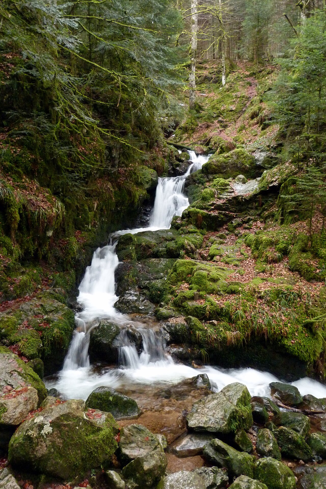
Wildenstein, a small village in the Thur valley in the Haut-Rhin, is the starting point for a set of waterfalls and glacial lakes that most people overlook, stopping instead at the large Lac de Kruth-Wildenstein. A few hours’ walk from the village leads to the Heidenbad waterfall and then the Bockloch waterfall. The two glacial lakes lie on the Munster valley side: the Munster valley tourist office gives Lac d’Altenweiher as an hour’s walk from Mittlach or a 45-minute descent from the ridge, while Lac du Forlet is reached by road, past Soultzeren toward the Col du Wettstein and then along a forest track. Below is a verified route for planning the outing, with actual access points and walking times.
The Heidenbad waterfall, at the edge of the village
The Heidenbad (“pagans’ bath”) is mentioned as early as 1831 by Achille Penot in his statistical survey of the Haut-Rhin department, described as the only waterfall in the Haut-Rhin worth the detour. The small valley was later occupied for nearly a century by weaving mills and spinning works, before the site regained its natural character thanks to the efforts of the local council, the Conseil général and the Conservatoire des sites alsaciens.
A discovery trail was created in 2001 by the CPIE des Hautes-Vosges: information points line the route, telling the natural and industrial history of the valley. It starts from the car park above the two ponds, at the edge of Wildenstein toward the Col du Bramont. The section leading to the viewpoint over the falls is fitted out for people with reduced mobility. Allow around 1h30 for the round trip, and take care in rain or frost, as some sections become slippery. Just below the observation platform, a natural pothole 3.5 m across, carved out by the swirling water, is thought to have given the waterfall its name.
Lac de Kruth-Wildenstein and the Bockloch waterfall
A few kilometres away, Lac de Kruth-Wildenstein fills the valley floor. Swimming is tolerated but not supervised, and fishing is allowed. Canoes, pedal boats and the tree-top adventure course are run beside the lake by the Parc Arbre Aventure, which closes in winter and reopens in spring. The site itself is managed by the Syndicat mixte du barrage de Kruth-Wildenstein. On the right bank, upstream of the lake, the Bockloch waterfall is fed by the Hinterbockloch stream, which rises at 1,060 m on the Grand Ventron massif. It roars in spring with the snowmelt and becomes quieter over summer.
From the waterfall, a circular walk of about 1h30, marked with the Club Vosgien’s blue cross, climbs toward the main track before dropping back down to the lake, with about 360 m of elevation gain. An information panel on site explains how the valley was formed. It is a good way to extend the Heidenbad outing into a half-day trip, provided you wear walking shoes suited to forest terrain.
On the other side of the ridge: Lac d’Altenweiher and Lac du Forlet
Beyond the heights that close off the Thur valley, on the Munster valley side, lie two glacial lakes that see fewer visitors than Lac de Longemer or Lac de Gérardmer.
Lac d’Altenweiher, in the commune of Mittlach, sits at 926 m in a cirque shaped by ancient glaciers, between the Kastelberg and Rainkopf summits. Covering 7.5 hectares with a depth of 14 m, it is held back by a straight dam 112 m long, built between 1886 and 1889. Access is on foot: around an hour from the village of Mittlach, or 45 minutes coming down from the ridge. Fishing is practised here.
Lac du Forlet, also known as Lac des Truites, lies in the commune of Soultzeren at 1,061 m: it is the highest lake in the entire Vosges massif, with 2.8 hectares set inside a former glacial cirque with steep walls, overlooked by the Tanet and the Gazon de Faîte. Like Lac de Blanchemer, another glacial cirque lake in the Hautes Vosges bordered by a floating peat bog, the Forlet combines peat bog, steep walls and stone scree, in a setting the Munster valley tourist office compares to an alpine one. A farm inn on the lakeshore serves traditional marcaire dishes with a view over the water, from 1 May to 1 November according to its official listing.
Lac d’Altenweiher can be reached from the heights, the Munster valley tourist office allowing 45 minutes for the descent from the ridge: from the valley, that first means climbing up to the ridgeline, a hike in its own right rather than a simple family stroll. Lac du Forlet, by contrast, is approached by road, past Soultzeren toward the Col du Wettstein and then along a forest track; no official source describes a walking route linking it to Wildenstein. Check beforehand with the Munster valley tourist office (03 89 77 31 80) about how practicable the route is at different times of year.
A possible detour: the Bubalafels waterfall
A little further south, in the commune of Moosch, the Bubalafels waterfall is reached via a short loop waymarked by the commune, about 0.9 km long, given as 45 minutes by the tourist office and rated suitable for everyone. It makes for an accessible addition if the main route stays focused around Wildenstein before heading back down the Thur valley toward Saint-Amarin.
Planning the outing
For a half-day from Wildenstein, the Heidenbad-then-Bockloch combination (via Lac de Kruth-Wildenstein) works well: the Heidenbad trail is easy (1.5 km, 57 m of ascent according to the official listing), while the Bockloch loop climbs 360 m and calls for a little more stamina. To add the two lakes, count on a mountain hike for the Altenweiher via the ridge, or a drive round through the Munster valley, with sturdy shoes and a picnic, since shops are found only down in the valley. As at Lac des Corbeaux, where swimming is forbidden, none of these sites offers a supervised swimming area: the appeal lies elsewhere, in the walking, the history of the places and landscapes that shift noticeably from one side of the ridge to the other.
Information and trail maps: Hautes Vosges d’Alsace tourist office, Saint-Amarin valley (03 89 82 13 90), and Munster valley tourist office (03 89 77 31 80).
The La Bresse guide, summer edition
Trails, lakes, blueberries and farm inns, in one free PDF.
Your details are used only to process this request. Privacy policy (in French).
Free PDF, no newsletter sign-up.
Frequently asked questions
How long does it take to reach the Heidenbad waterfall from Wildenstein?
The discovery trail starts from the car park above the two ponds, at the edge of the village toward the Col du Bramont. The round trip takes about 1h30 and involves no real difficulty. Part of the route, as far as the viewpoint over the falls, is accessible to people with reduced mobility.
Are Lac du Forlet and Lac des Truites the same place?
Yes. Lac du Forlet, also known as Lac des Truites, lies in the commune of Soultzeren at 1,061 m above sea level: it is the highest lake in the entire Vosges massif, set in a former glacial cirque with steep walls.
Can you swim in Lac d'Altenweiher or Lac du Forlet?
No official source mentions a designated swimming area at either lake, unlike Lac de Longemer; at Lac des Corbeaux, swimming is forbidden. These are hiking and fishing spots, worth seeing for their setting rather than for swimming.