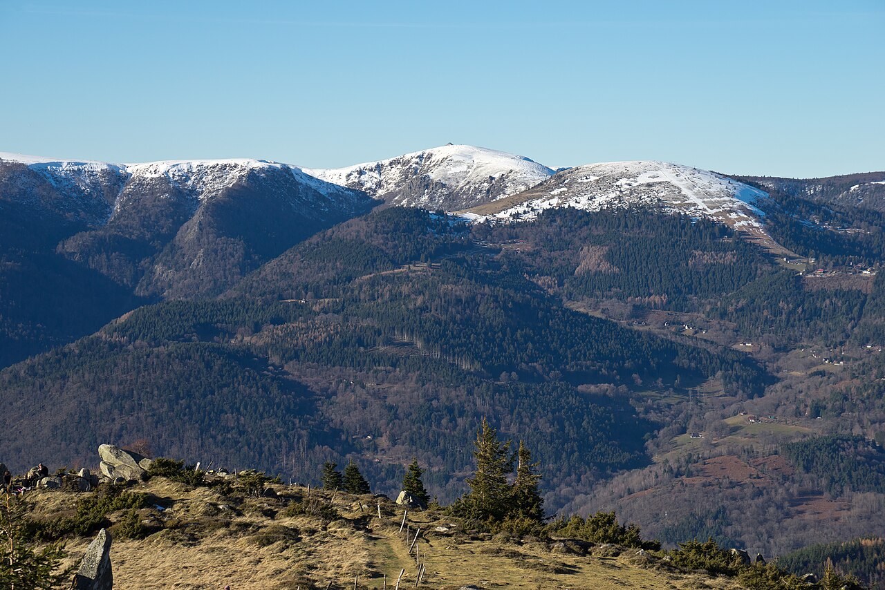
The Hohneck, at 1,363 metres, is the highest summit in the Vosges department. This guide avoids combining unrelated tracks: it compares only routes published by the La Bresse Tourist Office or the Ballons des Vosges Regional Nature Park.
The five options do not all serve the same purpose. Two reach the summit from Col de la Schlucht, two provide shorter walks in the Hohneck area, and one links the foot of the Hohneck with the Kastelberg.
Five official options compared
| Route | Start | Distance | Ascent | Indicative time | Reaches the summit? |
|---|---|---|---|---|---|
| Schlucht – Trois Fours | Col de la Schlucht | 4 km return | +125 m | 1 hr | No |
| Schlucht – Hohneck | Col de la Schlucht | 7.7 km return | +250 m | 2 hrs 30 | Yes |
| Schlucht – Hohneck – Le Collet | Col de la Schlucht | 9 km | +350 m | 3 hrs | Yes |
| Hohneck–Kastelberg snowfield trail | Foot of the Hohneck | not published | 1,166 to 1,346 m altitude | 3 hrs | Starts below the Hohneck |
| Tourbière des Feignes | La Bresse-Hohneck resort | 2 km | +52 m | 30 min | No |
Times are estimates. Conditions, stops and the group’s pace can change them.
1. Schlucht–Trois Fours: the short option
The official Schlucht–Hohneck guide first lists a return walk between Col de la Schlucht and Trois Fours: 4 km, about one hour and 125 metres of ascent.
It follows the GR5, marked by a red rectangle. This option does not reach the Hohneck summit; it provides a shorter walk in the ridge area.
2. Schlucht–Hohneck: the standard return hike
The summit option from Col de la Schlucht is 7.7 km return, with 250 metres of ascent and an indicative time of 2 hours 30 minutes. It also follows the GR5 and its red-rectangle markings.
The official guide places the route between Alsace and Lorraine, among high-altitude grassland and glacial cirques. Stay on the trail: part of the route enters the Frankenthal-Missheimle National Nature Reserve.
3. Schlucht–Hohneck–Le Collet: the 9 km loop
The third official option also starts at Col de la Schlucht, reaches the Hohneck and returns via Le Collet. Its published figures are 9 km, about three hours and 350 metres of ascent.
This loop is longer than the direct return. Use the current guide and the markings on the ground; place names alone are not enough to improvise a link between several trails.
4. The snowfield trail: Hohneck to Kastelberg
The Hohneck–Kastelberg snowfield trail starts from the car park at the foot of the Hohneck, beside the Route des Crêtes. The Tourist Office gives an approximate time of three hours, a low point of 1,166 m at Kastelbergwasen and a high point of 1,346 m at the Kastelberg summit.
The official route follows the GR5 towards Rainkopf, then the GR531 towards the Kastelbergwasen inn, before climbing back towards the Hohneck on the yellow-cross route. The paths can be stony, rocky and steep. Lingering snowfields may be unstable: stay on the path and do not walk on the remaining snow.
The Tourist Office explicitly states that this route is not passable in winter.
5. Tourbière des Feignes: a short walk near the resort
The Tourbière des Feignes loop starts at the La Bresse-Hohneck resort car park. The Tourist Office publishes 2 km, about 30 minutes and 52 metres of ascent, following green-ring markings.
It does not reach the summit. It is a shorter alternative when the Hohneck distance does not suit the group. The peatland is fragile: remain on marked paths and leave no trace.
Access and conditions to check
The official Hohneck page states that the access road closes in winter. In season, the Route des Crêtes provides access to the area, but road conditions may change. Read our Route des Crêtes guide and check official information on the day.
For a car-free summer approach, verify stops, connections and last departures in our 2026 Ridge Shuttle guide. A service published for one season should not be assumed to run unchanged the following year.
Safety and protected areas
The Regional Nature Park advises hikers to check the weather, carry water, wear suitable equipment and stay on marked paths. Dogs should be kept on a lead. Visitors must follow nature-reserve rules, close gates and avoid picking wild flowers.
Before setting out:
- check the weather and turn back if conditions exceed the group’s ability;
- wear walking shoes suited to stony ground;
- carry water and protection from sun, wind and rain;
- photograph or buy the relevant guide and follow the current markings;
- leave enough time to turn around before nightfall.
These summer itineraries are not advice for snow, ice or snowshoe conditions.
Blanchemer is not a verified direct route to the Hohneck
Lac de Blanchemer remains an important nearby site, but the official sources checked do not support the former 14 km loop described here as a Hohneck approach. For a reliable outing, the Tourist Office publishes a 1 km circuit around the lake from its car park. See access and rules in our Lac de Blanchemer guide.
Swimming and water sports, except fishing, are prohibited at Blanchemer. Do not rely on older descriptions presenting it as a summer swimming site.
Summit views and other walks
The summit orientation table helps identify the Alsace plain, the Black Forest and, when visibility allows, the Alps. For other marked walks, read our Ballons des Vosges Regional Nature Park guide and our family walks in La Bresse.
To stay near a chosen trailhead, compare chalets in La Bresse and check the actual driving time to the car park.
The La Bresse guide, summer edition
Trails, lakes, blueberries and farm inns, in one free PDF.
Your details are used only to process this request. Privacy policy (in French).
Free PDF, no newsletter sign-up.
Frequently asked questions
How far is the walk from Col de la Schlucht to the Hohneck?
The official guide gives 7.7 km return, about 2 hours 30 minutes and 250 metres of ascent via the GR5, marked with a red rectangle.
What is the shortest option from Col de la Schlucht?
The Schlucht–Trois Fours option is 4 km return, about one hour and 125 metres of ascent. It does not reach the Hohneck summit.
Is the Hohneck hike suitable for children?
There is no universal minimum age. Compare distance, ascent, weather and each child's walking experience. The Tourbière des Feignes loop, 2 km with 52 metres of ascent, is a shorter option nearby.
Can you hike the Hohneck in winter?
Do not apply these summer routes to winter conditions. The access road closes in winter, and the Tourist Office states that the snowfield trail is not passable then for safety reasons.
What can you see from the Hohneck summit?
The Tourist Office lists the Alsace plain, the Black Forest and, in clear weather, the Alps. The Hohneck summit stands at 1,363 metres.