
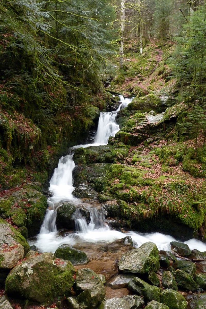
Twenty minutes from La Bresse, the Saut du Bouchot waterfall stays largely off the usual Hautes Vosges tourist trail, overshadowed by the Tendon waterfall or the Saut des Cuves. Yet it ranks among the finest falls in the massif: a 28-metre drop, a granite amphitheatre, and a site protected for more than a century. Here is what to know before heading out: how to get there, what you will find on site, and which hikes pair well with it.
A 28-metre waterfall, listed since 1925
The Bouchot stream winds through the Rochesson valley before tumbling down in three successive stages through a chaos of granite boulders. The fall reaches 28 metres in height before settling into a rocky pool and joining the waters of the Moselotte.
The site has been protected as a listed site (site classé) since 25 June 1925, covering 0.1 hectares, on the grounds of its artistic value. It is also registered as a type 2 ZNIEFF and sits within the Ballons des Vosges Regional Nature Park. Any change to the site’s condition or appearance (development, tree felling, construction) requires special authorisation from the State. This century-old protection governs any development project on the site. The official listings describe it as open access, with waymarked paths.
Getting there from La Bresse and from Sapois
The site sits on the route de Gerbamont, 88120 Sapois, on the boundary with the village of Gerbamont, between Gérardmer and Vagney. From La Bresse, the tourist office gives 15.5 km and around 20 minutes’ drive from the town centre, and describes a site easily reached from a dedicated car park. It notes that those driving times apply outside the summer season: allow more in July and August.
From Gérardmer, the route runs towards Rochesson and then Vagney. The waterfall sits just outside the village of Sapois, heading towards Gerbamont, not far from the Chapelle Saint-Del. The official listings announce a dedicated car park and clearly signed paths, without publishing the exact position of the parking or the length of the descent.
On site, a wooden bridge crosses the stream. To the left of the bridge, the smaller Bouchot waterfall forms a quieter trickle, next to the Pierre du Chasseur, a rock the Vosges Tourisme listing invites visitors to take on. The official listings describe two natural pools and a natural rock slide inside the amphitheatre, but none of them presents the site as a supervised bathing spot: the tourist office warns instead that the ground around the falls is damp and slippery, and asks visitors to watch children near the water.
The Crosery gorges, closed until further notice
The area is not limited to the waterfall. A 1.8 km botanical trail starts from the car park by the Thiéfosse church and leads to a footbridge overlooking the Moselotte. That walk does not reach the Saut du Bouchot: the waterfall is at Sapois, on the Bouchot stream, while the gorges cut through the Moselotte at Thiéfosse. They are two separate outings.
Important: the La Bresse Hautes Vosges tourist office states that, for safety reasons, access to the Moselotte in the Crosery gorges area and use of the footbridge spanning the gorges have been strictly prohibited since 12 April 2025 until further notice. Vosgesinfo.fr, which reported the closure on 14 April 2025, refers to advanced deterioration at the feet of the structure. The Voie Verte des Hautes Vosges runs through the area, but the ban applies to cyclists in the same way. While it stands, the outing is limited to the foot of the waterfall at Sapois: check with the tourist office or the Thiéfosse town hall before considering the botanical trail.
To compare this site with other waterfalls in the Hautes Vosges, the article on the Tendon waterfall covers the longest fall in the Vosges. Note that the tourist office reports that, since 4 August 2026 and until further notice, the car park at the small Tendon waterfall is closed to motor and electric vehicles, with access on foot from the car park on the place de Tendon. The two sites work well together over a multi-day stay rather than in a single outing.
When to go and what to know beforehand
In wet weather, the Bouchot’s flow rises noticeably and the waterfall gains in power, making it a sight particularly sought after by photographers after a rainy spell. Conversely, during dry summer periods, the flow drops sharply and the fall loses much of its power.
The access path crosses forested, rocky ground that can be damp. The tourist office recommends hiking shoes with lugged soles, even for short walks. As with all listed sites in the massif, it is best to stay on the marked paths: the protected status covers the vegetation as well as the rock formations of the amphitheatre.
The outing pairs well with stops on the way back to La Bresse, some fifteen kilometres from the waterfall. The Brabant goat farm offers a visit with tasting at the Col du Brabant, and the Saichy farm, on the route de Lispach, lets you pick up farmhouse munster cheese. In autumn, the same massif also hosts the deer rut, a dusk outing to combine with a nature-focused stay.
Key facts
The Saut du Bouchot is a 28-metre waterfall at Sapois, on the boundary with Gerbamont, listed as a protected site on 25 June 1925 over 0.1 hectares. The tourist office places it 15.5 km and 20 minutes from La Bresse, on the route de Gerbamont, with a dedicated car park, a wooden bridge and a smaller waterfall nearby, next to the Pierre du Chasseur. Access to the Moselotte in the Crosery gorges and the footbridge on the Thiéfosse botanical trail, however, have been strictly prohibited since 12 April 2025 until further notice, and that trail does not lead to the waterfall. Check access conditions with the La Bresse Hautes Vosges tourist office beforehand.
The La Bresse guide, summer edition
Trails, lakes, blueberries and farm inns, in one free PDF.
Your details are used only to process this request. Privacy policy (in French).
Free PDF, no newsletter sign-up.
Frequently asked questions
How tall is the Saut du Bouchot waterfall?
28 metres, according to the official listing from the La Bresse Hautes Vosges tourist office and the protected-site file from DREAL Grand Est. The Bouchot stream drops in three stages through a chaos of granite boulders.
Where is the Saut du Bouchot waterfall?
On the boundary between the villages of Sapois and Gerbamont, between Gérardmer and Vagney, on the route de Gerbamont (88120 Sapois). The tourist office places the site 15.5 km from La Bresse, roughly a 20-minute drive.
Is the Saut du Bouchot a protected site?
Yes. It has been listed as a protected site (site classé) since 25 June 1925 on artistic grounds, covering 0.1 hectares. It is also registered as a type 2 ZNIEFF within the Ballons des Vosges Regional Nature Park. Any change to its condition requires state authorisation.