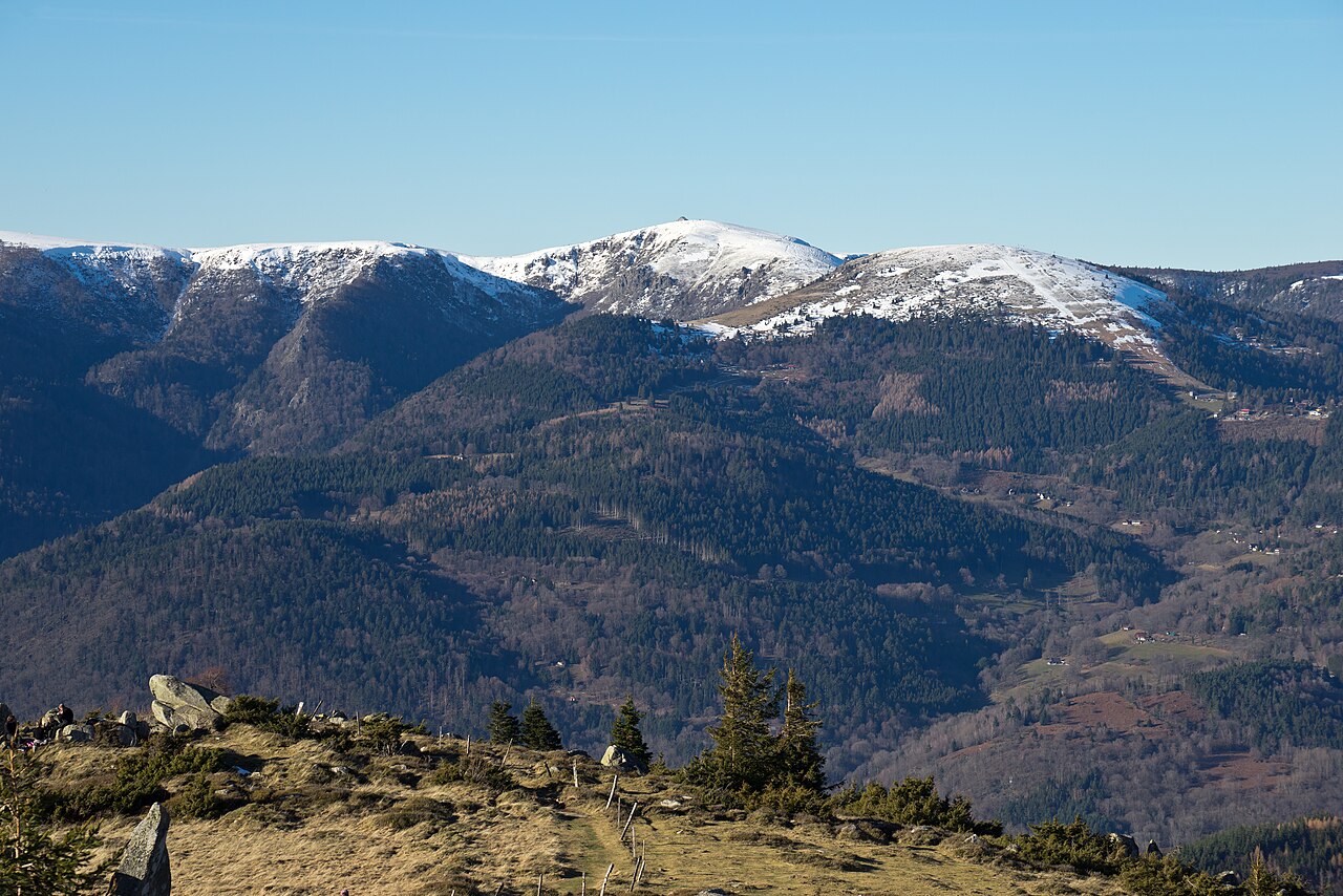
The Petit Ballon rises to 1,272 m between the Munster and Guebwiller valleys, inside the Parc naturel régional des Ballons des Vosges. Less well known than its neighbour the Grand Ballon, it is approached from Wasserbourg, Luttenbach or Sondernach, with the tourist office counting around 20 minutes of walking from the route to reach the summit, which makes it a quieter outing for anyone looking for a panorama at the end of a footpath. This guide covers access, the official circuit and the practical details for planning the trip from La Bresse.
Access and parking at the Col du Petit Ballon
The starting point of the official circuit is the Col du Petit Ballon, in the Munster valley. From Munster, the Munster Valley Tourist Office notes indicate taking the D10, then turning left before the sign for Luttenbach-près-Munster towards the farm-inns and the Petit Ballon. Allow around 15 minutes of driving, passing the Ferme-Auberge du Kahlenwasen, then park at the col car park, a little further up.
From La Bresse, the road route goes via the Col de la Schlucht and down to Munster before reaching Luttenbach: plan on a half-day of driving and walking rather than a quick stop. If the Ballon d’Alsace massif is also on your list, don’t mix up the two summits: the Ballon d’Alsace guide covers a separate massif, on the Saint-Maurice-sur-Moselle side, with its own access and its own Maison du Ballon.
The official Tour du Petit Ballon circuit
The circuit published by the Office de Tourisme de la Vallée de Munster runs 5 km with 250 m of ascent, in around 2 hours, and the tourist office rates it intermediate level. From the car park, a marked path leads to the summit alongside a pasture fence. At the top, the route follows the signs for the Strohberg and the statue of the Virgin Mary, then descends via a different marked path overlooking the Wasserbourg valley, before reaching the Strohberg and Rothenbrunnen farm-inns and looping back to the start.
The trail crosses the GR532 without following it, and passes First World War remains as well as the Amis de la Nature refuge, visible below the path. A variant flagged by the tourist office extends the outing along the Steinberg megaliths trail, which also starts from the col car park.
For maps, the tourist office recommends the Club Vosgien Vallée de Munster map or the IGN TOP 25 n°3719 map. The path is not passable in snow on the descending stretch overlooking the Wasserbourg valley, according to the official information sheet.
Farm-inns around the summit
Within a 30-minute radius, on foot or by car, four farm-inns are within reach: Rothenbrunnen, Kahlenwasen, Buchwald and Strohberg. The circuit itself passes the Strohberg and Rothenbrunnen ones, which makes a meal stop along the way easy. Check opening days and hours directly with each operator before setting off, as these change with the season.
Petit Ballon or Grand Ballon: which summit to choose
The main difference is access. The Grand Ballon, the highest peak in the Vosges at 1,424 m, is reached by car right up to the summit area, via the Route des Crêtes in season: its official information sheet states that the stretch between the Col de la Schlucht and the Grand Ballon is closed in winter, access then being via Willer-sur-Thur and Goldbach. The Petit Ballon, on the other hand, finishes on foot, with around 20 minutes of climbing from the route whichever side you start from. For a short family outing with a car park close to the highest point, the Grand Ballon remains the simpler option. For a proper hike with historical remains and farm-inn stops, the Petit Ballon fits better.
Both summits belong to the same massif and pair well over a multi-day stay in the Hautes Vosges, without needing to combine them in a single day.
Getting ready for the outing
The path climbs through forest before opening onto the high pastures, exposed to wind even in summer. Bring hiking shoes, water and a windproof layer. As on any circuit in the massif, stay on marked paths and respect the fences and livestock on the pastures.
On the way back to La Bresse, a cool break at the Vosges lakes rounds off the day, or change pace the next day with the thrill activities at Bol d’Air park, a zip line and treetop adventure course in the Vosges forest.
The La Bresse guide, summer edition
Trails, lakes, blueberries and farm inns, in one free PDF.
Your details are used only to process this request. Privacy policy (in French).
Free PDF, no newsletter sign-up.
Frequently asked questions
What is the altitude of the Petit Ballon?
The summit stands at 1,272 m, the altitude on the summit signpost quoted in the Munster Valley Tourist Office information sheet. It overlooks the Munster valley on one side and the Guebwiller valley on the other.
Where can you park to hike up to the Petit Ballon?
The car park is at the Col du Petit Ballon. From Munster, take the D10, turn left before the sign for Luttenbach-près-Munster towards the farm-inns and the Petit Ballon, then follow this road for around 15 minutes, passing the Ferme-Auberge du Kahlenwasen.
How long does the Tour du Petit Ballon take?
The official circuit published by the Office de Tourisme de la Vallée de Munster is 5 km with 250 m of ascent, taking around 2 hours. The tourist office rates it intermediate level.