Riding the Ballon d’Alsace from La Bresse by bike has two parts: reaching Saint-Maurice-sur-Moselle, then following the official D465 profile. The col has a major place in cycling history, but figures copied online often confuse access roads, the natural summit and the measured climbs. This guide uses data published by the official tourism bodies.
From La Bresse to the official start
From La Bresse, the road approach runs through Cornimont, Le Ménil and Le Thillot before reaching Saint-Maurice-sur-Moselle. The official Ballon road then leaves the RN66 for the D465.
The B10 cyclosport route starts opposite the Saint-Maurice-sur-Moselle tourist office. It describes an 18 km out-and-back, with 620 m of elevation gain and an indicative time of 1 hour 15 minutes, rated difficult. The one-way climb itself is 9 km. That duration is the tourism sheet’s indication, not a performance target.
The full distance from La Bresse changes with the exact starting point, diversions and return route. Plot the complete ride in a navigation tool instead of applying one fixed total to every stay. The valley approach uses roads open to traffic; starting directly in Saint-Maurice removes that section.
The 3 official Ballon d’Alsace road climbs
Destination Ballon d’Alsace publishes three climbing roads, one from each valley. The figures below reproduce that source as checked on 15 July 2026.
| Official start | Direction | Distance | Elevation gain | Average gradient | Published feature |
|---|---|---|---|---|---|
| Saint-Maurice-sur-Moselle | north | 9 km | 621 m | 6.9% | regular gradient from 5.5 to 8% |
| Lepuix | south | 14.7 km | 670 m | 4.6% | described as the easiest side, gradients up to 7% |
| Sewen | east | 13.2 km | 670 m | 5.1% | 4 km at 7–9% mid-climb, then a shared finish with Lepuix |
Saint-Maurice-sur-Moselle: the historic side
This is the side reached directly from La Bresse. According to the Vosges Tourisme B10 sheet, the D465 has 12 hairpins. With a 6.9% average and a published range of 5.5 to 8%, its effort is more even than the Sewen climb.
Lepuix: the most gradual climb
The measured start is Lepuix, although the road approach from Belfort passes through Giromagny. At 14.7 km, this is the longest profile, but its 4.6% average is the lowest. Destination Ballon d’Alsace lists gradients of no more than 7%.
Sewen: the lakes followed by four sustained kilometres
The Sewen side follows the Doller valley on the D466 and passes through the area of the Sewen and Alfeld lakes. Its main difficulty is concentrated into four kilometres at 7–9% halfway up. The final section joins the road from Lepuix.
Why there are not four independent sides
Bussang and Giromagny are useful approach towns, but the official documents do not list them as additional climbs:
- from Bussang, the RN66 leads to Saint-Maurice-sur-Moselle, where the north climb begins;
- from Giromagny, the RD465 runs through Lepuix, the start of the south climb.
Calling these four sides and assigning separate profiles to Bussang or Giromagny therefore counts two roads twice. Use the measured start when comparing rides: Saint-Maurice, Lepuix or Sewen.
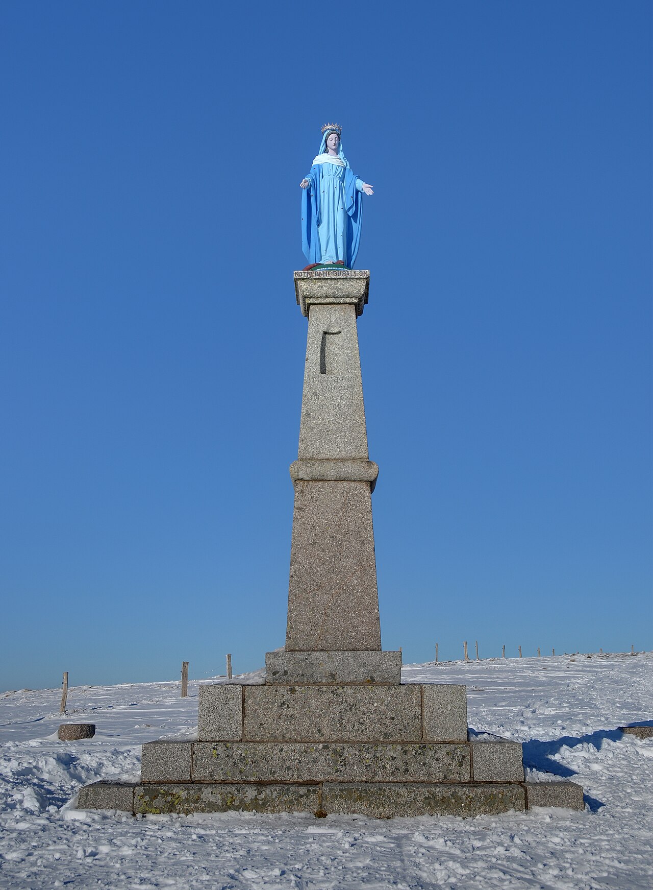
Road col and natural summit: two altitudes
The official pages use slightly different elevations for the road col: 1,171 m on Destination Ballon d’Alsace and 1,178 m on the B10 sheet. It is more accurate to describe the road col as sitting at about 1,170 m.
According to Vosges Tourisme, the natural summit, reached by trails, stands at 1,247 m. A rider at the road col has not climbed a road to 1,247 m: that figure describes the mountain, not the end of the cycling profile.
The Tour de France’s first major col
The Ballon d’Alsace was the first major col crossed by Tour de France riders, in 1905. René Pottier led over it and repeated the feat in 1906, the year he won the Tour. The Tour’s 2026 heritage page records 28 crossings and notes that Giulio Ciccone led over the summit in 2023, the last men’s passage before 2026.
Stage 14 of the 2026 Tour de France, from Mulhouse to Le Markstein Fellering, lists the Ballon d’Alsace at kilometre 94.4. A race can bring temporary restrictions, so consult the organiser’s route and the relevant departmental road updates before riding.
Water, repairs and food
The Saint-Maurice-sur-Moselle tourist office, an Accueil Vélo-certified facility, is a useful stop at the foot of the climb. France Vélo Tourisme lists:
- a water point and bike pump near the greenway;
- a kit for minor repairs;
- three chargers for Bosch e-bike batteries;
- cycling maps and route information.
Official listings include inns and restaurants near the col, including the Langenberg area, but their opening days and hours change. Check the chosen venue and carry enough supplies to remain self-sufficient. Our guide to farm inns around La Bresse helps plan a stop without treating seasonal opening as fixed.
Cycling season and safety
All three itineraries are mountain roads shared with motor vehicles. Before setting out:
- check the day’s weather, traffic and any road closures;
- inspect brakes and tyres before the long descents;
- carry a windproof layer even if the valley is mild;
- take water, food, lights and a repair kit;
- adapt the ride if the surface is wet, snowy or congested.
In winter, Destination Ballon d’Alsace says the approaches from Masevaux/Sewen and Giromagny/Lepuix are cleared but not salted; the Vosges access from Saint-Maurice is the exception. This information does not replace a same-day road check.
Road bike, gravel and other routes
The three profiles on this page cover paved roads. They do not validate a forest gravel loop or confirm that a trail is open. For off-road riding, start with a published route, check local rules and see our gravel loops around La Bresse.
For a broader cycling stay, compare this climb with the Vosges Route des Crêtes, La Bresse Bike Park and Vosges mountain-bike circuits. These activities do not necessarily use the same roads or difficulty scale.
To plan several rides from one base, see the chalets available in La Bresse.
Sources and verification date
The three profiles, access and altitude were checked on 15 July 2026 against Destination Ballon d’Alsace and Vosges Tourisme. Tour history was cross-checked with the official Tour de France website, and the Saint-Maurice cyclist services with France Vélo Tourisme. Check current road conditions and opening hours before departure.
The La Bresse guide, cycling edition
Bike park, mountain-bike and road routes, lakes for the break: the free PDF for the massif.
Your details are used only to process this request. Privacy policy (in French).
Free PDF, no newsletter sign-up.
Frequently asked questions
What is the Ballon d'Alsace profile from Saint-Maurice-sur-Moselle?
The official profile gives 9 km, 621 m of elevation gain and a 6.9% average gradient. The listed gradients range from 5.5 to 8%.
How many road climbs does the Ballon d'Alsace have?
Destination Ballon d'Alsace publishes three climbs: Saint-Maurice-sur-Moselle, Lepuix and Sewen. Bussang leads to Saint-Maurice and Giromagny to Lepuix; they are not separate profiles.
Which side is the most accessible by bike?
The official page describes Lepuix as the easiest side: 14.7 km, 670 m of elevation gain, a 4.6% average and gradients reaching no more than 7%.
What is the altitude of the Ballon d'Alsace?
Official pages place the road col at about 1,170 m, while the natural summit of the Ballon d'Alsace reaches 1,247 m. The road cycling profiles finish at the col.