
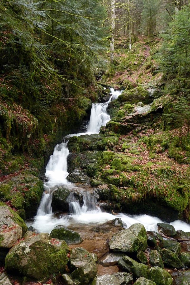
The Pissoire waterfall is located at Le Haut du Tôt, in the commune of Vagney, 22 km from La Bresse. It’s a modest forest waterfall crossed by small wooden footbridges, less well known than the Saut du Bouchot or the Tendon waterfall but just as accessible for a short walk. Here’s what the tourist office says about access, parking, and the official trail that leads there.
A small waterfall deep in the Le Haut du Tôt forest
The waterfall is fed by the Blancfaing stream, which changes name once past the falls: downstream, it becomes the Ruisseau de la Pissoire. That’s the detail highlighted in the official fact sheet from the La Bresse Hautes Vosges tourist office, which describes a site that is “modest but charming,” deep in the forest, with its small wooden footbridges. No waterfall height is published on the official fact sheets consulted here: it’s better not to state a figure these sources don’t give.
The site is part of the Parc Naturel Régional des Ballons des Vosges. Dogs on a leash are allowed there, according to the Massif des Vosges tourism site, which repeats the same information as the La Bresse tourist office.
Access from La Bresse: distance and parking
According to the tourist office’s “Balades au pied des cascades vosgiennes” fact sheet, the Pissoire waterfall is 22 km from La Bresse, or about 32 minutes by car. That makes it one of the most distant waterfalls from the resort center among those listed by the tourist office, farther than the Saut du Bouchot (15.5 km, 20 minutes).
The address to use for the trip is Le Haut du Tôt, 88120 Vagney. The hamlet itself sits 7 km from Vagney and 13 km from Gérardmer, at an elevation of 840 m: the tourist office presents it as the highest parish in the Vosges, even though it has no town hall of its own and falls administratively under Sapois or Vagney depending on the street.
The starting point for reaching the waterfall on foot is the car park on the church square in Le Haut du Tôt. It’s also the starting point for the marked trail described below.
The official Croix des Hêtres trail, with the waterfall and Blancfaing pond
The tourist office lists a marked route that takes in the Pissoire waterfall: the Croix des Hêtres walk. It starts from the car park on the church square in Le Haut du Tôt; from there, take the path behind the church, opposite the main road, then follow the markers toward the Blancfaing pond.
The circuit takes about 2h30 and alternates between forest and upland meadows. Along the way, the tourist office mentions three points of interest:
- the Pissoire waterfall
- the Blancfaing pond
- the Moyemont viewpoint table
Neither the distance in kilometres nor the elevation gain is specified on the official fact sheet, unlike other trails in the area such as the Mérelle waterfall circuit in Gérardmer, which lists 5.4 km and 240 m of elevation gain. For a shorter visit, limited to the waterfall without doing the full loop, no timed duration is published either: expect a walk from the same church car park, with no more precise official figure available.
Nearby: Croix des Hêtres, Chèvre-Roche, and Chambre du Loup
The tourist office highlights three other sites to combine with a visit, all reachable from the same Le Haut du Tôt area: the Croix des Hêtres, the Chèvre-Roche viewpoint, and the Chambre du Loup walk. The hamlet also hosts the Fête des Plantes every second Sunday in August, dedicated to medicinal and aromatic plants and local produce.
To extend the stay elsewhere in the Hautes Vosges, the Col de la Schlucht remains the go-to spot for a ridge hike with views over the high pastures, a good half-hour’s drive from Le Haut du Tôt. Those looking for a walk without elevation gain can instead head to the peat bog at Lac de Lispach, on a flat, educational trail.
When to go and precautions on site
The forest path stays damp for much of the year, especially near the wooden footbridges and after rain: closed hiking shoes are recommended, even for a short visit. Like other Vosges waterways, the flow of the Blancfaing stream varies with the season: heavier in spring and after strong rainfall, lighter during a dry summer.
No admission fee or closing time is published for this site: access stays free year-round, as is the case for most of the massif’s forest waterfalls. If the weather turns rainy during the stay, head instead for the indoor activity ideas gathered in our article on what to do in La Bresse when it rains.
To compare the Pissoire waterfall with the five other falls listed around La Bresse (Tendon, Saut du Bouchot, Cuisinier, Morbieux, and Battion), our comparison of waterfalls around La Bresse remains the most complete starting point for planning a week of nature walks in the Hautes Vosges.
The La Bresse guide, summer edition
Trails, lakes, blueberries and farm inns, in one free PDF.
Your details are used only to process this request. Privacy policy (in French).
Free PDF, no newsletter sign-up.
Frequently asked questions
Where is the Pissoire waterfall located?
In the hamlet of Le Haut du Tôt, in the commune of Vagney (88120), 22 km from La Bresse according to the tourist office, or about 32 minutes by car. Le Haut du Tôt is also the highest parish in the Vosges, at an elevation of 840 m.
How long is the walk to see the waterfall?
The tourist office doesn't publish a walking time for a simple visit to the site. The official Croix des Hêtres circuit, which passes the waterfall, the Blancfaing pond, and the Moyemont viewpoint table, takes about 2h30 starting from the church car park in Le Haut du Tôt.
Is there a fee to access the Pissoire waterfall?
No, access is free. The tourist office lists no fee or opening hours for this forest site within the Parc Naturel Régional des Ballons des Vosges.