
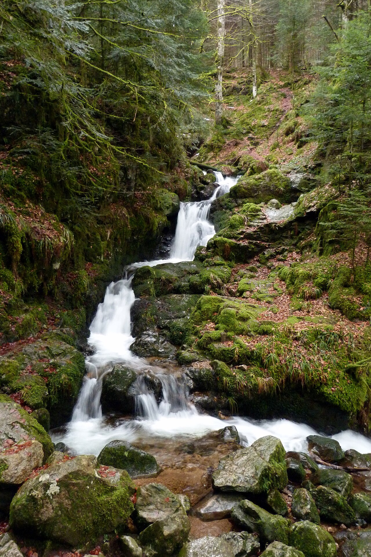
Two waterfalls in the Hautes Vosges lend themselves to a short outing: the Cuisinier waterfall in Ventron, described by the tourist office as a family circuit, and the Faymont waterfall in Val-d’Ajol, whose official sheet gives neither a walking distance nor a difficulty rating. The ground around the Cuisinier is flagged as slippery. Here is what the official sheets say about access, parking and walking time.
Cuisinier waterfall, in Ventron
The Cuisinier waterfall sits in the Véternate forest, in the town of Ventron. The Ventron tourist office sheet published on the Massif des Vosges portal describes it as a family circuit of 2 km, walkable in around 45 minutes. The La Bresse tourist office lists access as free.
Access is described as easy, with one important caveat: the La Bresse tourist office sheet flags the surroundings of the waterfall as slippery. That caution applies even on a short walk, especially with young children or in wet weather. The same sheet presents the site as a family break and a refreshing stop, without heavy logistics.
To compare with other waterfalls in the same area, the roundup of waterfalls around La Bresse places the Cuisinier among five other sites reachable from the centre of La Bresse.
Faymont waterfall, in Val-d’Ajol
The Faymont waterfall is located at Faymont, in the town of Val-d’Ajol, south of Remiremont. It is formed by the Dréhart stream, with a total drop of around twenty metres spread over several steps. The last step, 2.50 m high, ends in an artificial basin that once powered the machinery of a nearby sawmill.
Access is via the D23, then by following the signposted route. The official Vosges Tourisme sheet mentions free access on marked trails, a coach parking area and pets welcome. It does not give a walking distance for the simple view of the waterfall from the car park: better not to invent a figure the source does not provide.
A longer hike also exists under the same name. The Remiremont-Plombières tourist office lists it as an 8.7 km circuit, around 3 hours of walking and 255 m of elevation gain, rated difficult and marked with a blue circle. The car park for this hike is 100 metres from the “Cascade de Faymont” sign. This route crosses conifer forests, passes near the Roche Joséphine and comes back down via the Croix du Remoiriot: it is not a simple visit to the waterfall and calls for a more sustained level of walking.
If you are looking for another waterfall to pair with a short access walk, the cascade de Tendon also separates a short site stop from a longer official hike, with a comparable setup.
Which waterfall fits your plans
For a short family break without much walking, Cuisinier remains the easiest option to plan ahead: 2 km and 45 minutes are official figures you can use directly to organise a half day. For Faymont, the site itself can be seen from a nearby car park, but as soon as you add the full 8.7 km circuit, the outing changes in nature and calls for setting aside a whole morning or afternoon, with sturdy footwear.
The two sites share one common point: caution near the water. Wet ground, mossy rocks and roots make the surroundings slippery, even where access is described as easy. Adapt the outing to the age and physical condition of your group, and turn back if the ground is not suitable on the day.
For another flat nature outing in the La Bresse area, the Lispach lake peat bog offers a 4.5 km educational trail, partly on boardwalks, rated very easy.
Access, season and precautions
Neither official sheet mentions closing times or an entry fee: both sites have free access. The flow of the waterfalls varies a lot with the season and recent rainfall: heavier in spring and after strong rain, lower during the dry summer period. Before setting off, check the local weather and bring footwear suited to potentially wet ground, whichever waterfall you choose.
For school groups or tour coaches, only the Faymont waterfall sheet lists a coach parking area and states that groups are welcome. No Cuisinier waterfall sheet mentions parking, so check with the tourist office before organising a group outing.
The La Bresse guide, summer edition
Trails, lakes, blueberries and farm inns, in one free PDF.
Your details are used only to process this request. Privacy policy (in French).
Free PDF, no newsletter sign-up.
Frequently asked questions
How long is the walk to the Cuisinier waterfall?
The Ventron tourist office sheet published on the Massif des Vosges portal gives a family circuit of 2 km and around 45 minutes of walking. The La Bresse tourist office lists access as free.
Can you see the Faymont waterfall without a long hike?
The official Vosges Tourisme sheet describes access via the D23 with signposting and a coach parking area, without giving a walking distance for just the view of the waterfall. The Remiremont-Plombières tourist office places the hike car park 100 metres from the sign, but that separate 8.7 km, 3 hour circuit is rated difficult.
Do these two waterfalls charge an entry fee?
No. The Cuisinier waterfall has free access according to the La Bresse tourist office. The Faymont waterfall sheet mentions free visits, with no fee stated.